OpenDroneMap — Use Cases


OpenDroneMap (ODM), as an open source photogrammetry toolkit, that is increasingly being used in humanitarian and development scenarios.
In this post we will take a step back from technical project updates and look at some use cases of drone image processing.
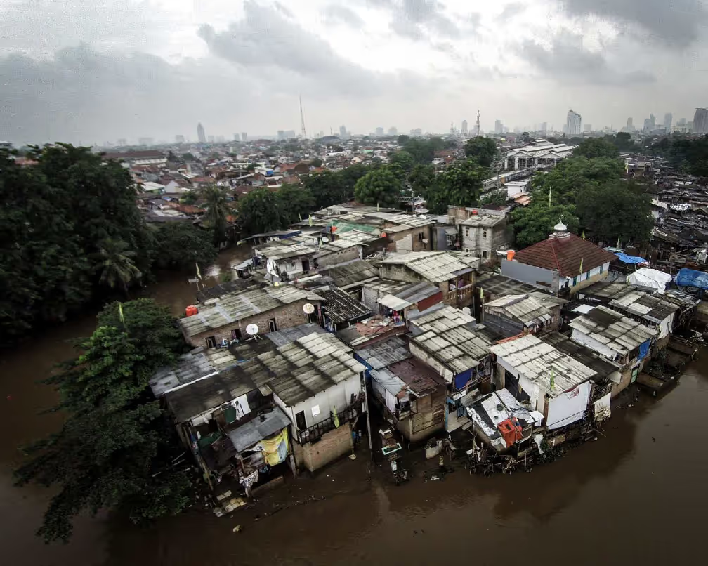
Our proposed location for ODM deployment was Indonesia, so we were very pleased when the Humanitarian OpenStreetMap Team (HOT) Indonesia asked for a training on the use of OpenDroneMap. The ODM team provided an introduction to WebODM to the HOT Pacific Disaster Center (PDC) team, Indonesia Disaster Management Agency, and the World Food Programme Jakarta. HOT has since begun testing the use of ODM through WebODM for processing imagery over Jakarta.
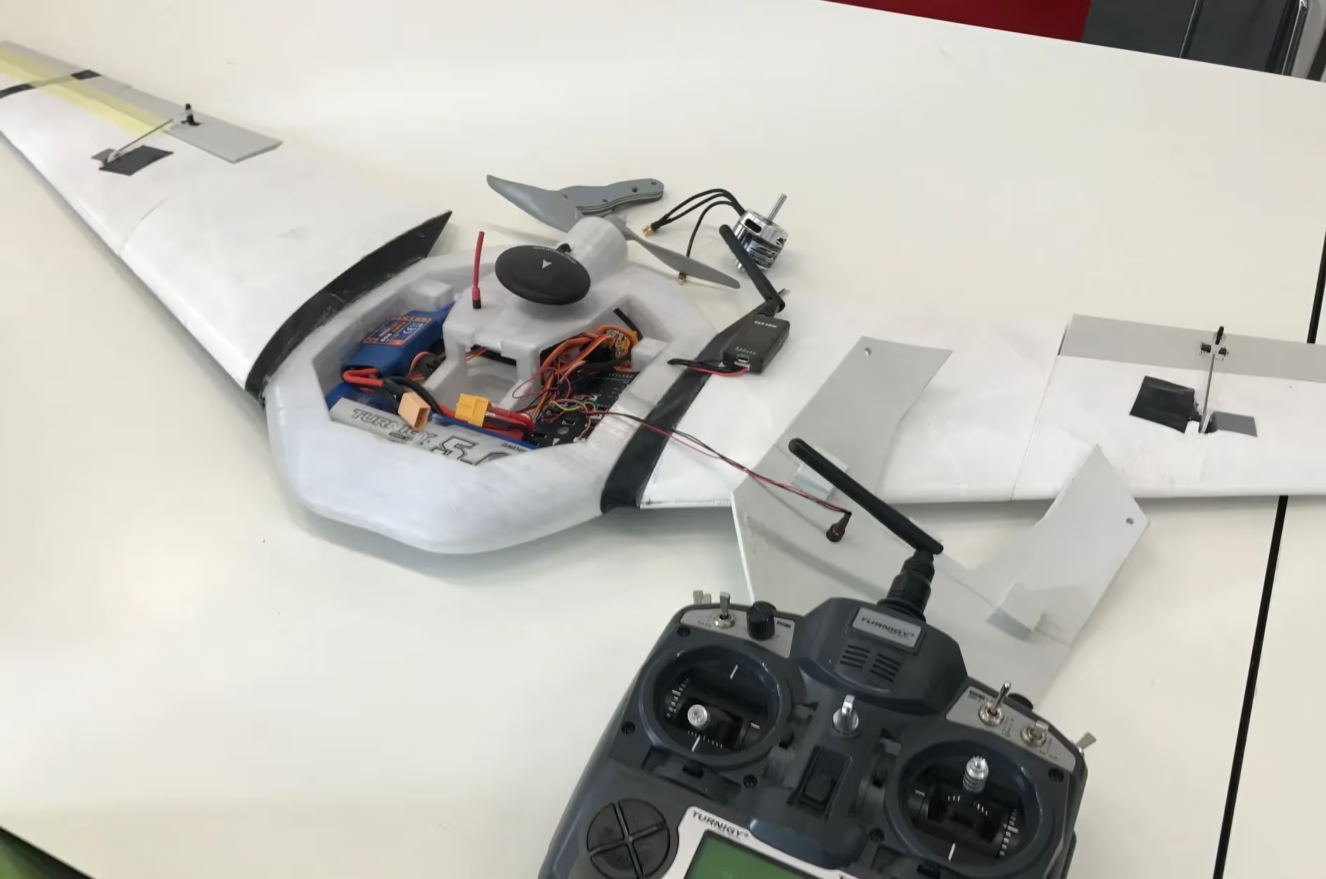
Initial work has also been done to coordinate ODM with Médecins Sans Frontières Japan's LOCUS project:
LOCUS in collaboration with MSF Japan have created the first 3D printed surveillance drone to re-create maps in forgotten places for MissingMaps.org".
As the project continues to be refined by designers at De Haagse Hogeschool in the Hague, Netherlands, the ODM team will train and provide test instances of ODM to LOCUS collaborators.
When the LOCUS project is completed, it will be possible to have a fully free and open source solution for both hardware and software. This is very compelling from the perspectives of field serviceability, innovation, scaling, and cost.
American Red Cross International Service Division have integrated ODM into their in-field OpenStreetMap ecosystem: Portable OpenStreetMap (POSM). Tindog Tabang Leyteño (Stand Up, Help Leyteños) is a project in partnership with the Philippine Red Cross in response to the disaster caused by Typhoon Haiyan (Yolanda), the strongest typhoon to ever make landfall in the Philippines.
Due to the size of the collection efforts, datasets collected as part of this project are proving a challenge to process with other tools, so the ODM team is working to adapt ODM to process this imagery with the expectation that these improvements will help other users of large datasets in the future.
Since November of 2016, the OpenDroneMap team has been doing sporadic work in Tanzania. We have been proud to collaborate with Khadija Abdullah Ali, a recent graduate of State University Zanzibar (SUZA) Tunguu, and former volunteer pilot for the Zanzibar Mapping Initiative (ZMI). For a final project at University, Khadija compared the outputs from commercial closed source photogrammetry software and OpenDroneMap, and also created VirtualSUZA with WebOpenDroneMap (WebODM).

Stay updated
Sign up for our newsletter to receive regular updates on resources, news, and insights like this. Don’t miss out on important information that can help you stay informed and engaged.


Explore Elrha
Learn more about our mission, the organisations we support, and the resources we provide to drive research and innovation in humanitarian response.